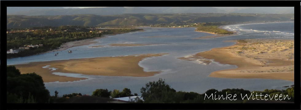
Keurbooms Estuary
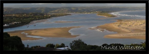
An estuary, according to the National Environmental Management: Integrated Coastal Management Act (No. 24 of 2008) (ICM Act), is defined as: a body of surface water – (a) that is part of a water course that is permanently or periodically open to the sea; (b) in which a rise and fall of the water level as a result of the tides is measureable at spring tides when the water course is open to the sea; or (c) in respect of which the salinity is measurably higher as a result of the influence of the sea. Estuaries are vitally important ecosystems, and the true value of these ecosystems is reflected in the number of ecosystem services that they provide. Estuaries are at the interface of terrestrial, freshwater, and marine environments and as such form unique habitat types that support a variety of endemic fauna and flora. Estuaries are important: as nursery areas for fish; as roosting, feeding, and breeding areas for resident and migratory birds; as areas for erosion control, sediment supply, nutrient cycling, and disturbance regulation; and as areas of aesthetic, educational, spiritual, and scientific value. In Plettenberg Bay the Keurbooms and Bitou estuaries join into what is known as Keurbooms Lagoon, all collectively known as the Keurbooms. The Keurbooms and Bitou rivers meet roughly 3.5km from the river mouth. The Keurbooms River is 85km long with its source at Spitskop in the Outeniqua Mountains, and is tidal for 8.5km from the confluence, and the Bitou River is 23km long with its source at Buffelsnek, and is tidal for 7.2km from the confluence. Both rivers feed into the Keurbooms Lagoon (a back-barrier lagoon) which is separated from the sea by a prominent berm (Keurbooms Peninsula) prior to it flowing out to the sea. Keurbooms is classified as a warm temperate, permanently open, medium-large system. Both the Keurbooms and Bitou estuary systems have extensive intertidal areas dominated by sandbanks, mudbanks, and saltmarshes. Further upstream the Keurbooms Estuary has no floodplain and is characterized by steep gorges, while the Bitou Estuary has an extensive floodplain and wetland complex. The Keurbooms is a highly biodiverse area, but is not without threats including abstraction of water, overexploitation of natural resources, and structures in the intertidal and supratidal (floodplain) area.
Written by: Minke Witteveen
For further reading:
- Enviro-Fish Africa (Pty) Ltd. 2010. Keurbooms/Bitou Estuary Management Plan: Situation Assessment. Produced for: C.A.P.E. Estuaries Management Programme, and Eden District Municipality. Enviro-Fish Africa (Pty) Ltd, Grahamstown.